
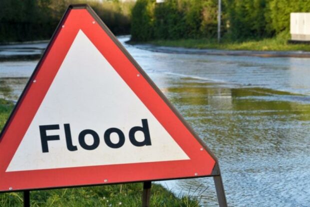
There are over three million properties at risk of surface water flooding in England. Surface water flooding happens when rain from major storms overwhelms local drainage. It is a real and growing threat to life, property, infrastructure, and to the economy.
Our changing climate will bring more intense summer rainfall events, like those that caused so much disruption in London in 2021. The latest climate science predicts winter rainfall could increase by up to 59% by the end of the century. We must take action now to manage the increasing risks of surface water flooding.
Lead local flood authorities are responsible for managing surface water flood risks on the ground, but the Environment Agency has a legal supervision over all sources of flooding. This ‘strategic overview’ role is distinct from the day-to-day operational role we have for managing flood risk from rivers and the sea.
Local authorities are best placed to understand their surface water risk. However, we can play our part by assessing current and future risk, bringing partners together and allocating funding where it will have the greatest impact. Collectively all these activities allow the public, local authorities, and business, to better plan, protect, respond to and recover quickly from its effects. Here are some examples that are making a real difference.
Using £2 million of government funding we supported 28 local authorities to produce detailed surface water models and maps that benefit 3.3 million people across the country. We’re not stopping there, as we will also provide a further £1.5 million to support other local authorities to do the same, benefiting a further three million people. All this information will be freely available from our Check Your Long Term Flood Risk webpage.
We’ll also be overhauling our national flood risk mapping (National Assessment of Flood Risk) in 2024. The new mapping will be nationally consistent, use local information wherever possible and provide a much greater level of detail. It will show the impacts of a changing climate from increases in rainfall intensity, providing people and places with the information they need to plan and adapt.
Improving our understanding of risk is only part of the story. We also need tangible actions that make a difference.As part of the government’s £5.2 billion programme for flood risk reduction, we have allocated funding for hundreds of projects up and down the country to better protect people and properties from surface water flooding. Through the £150 million Flood and Coastal Resilience Innovation Programme we are working with local authorities to develop practical and innovative actions to bolster the resilience of communities at risk of surface water flooding. The North East Lincolnshire project is using real-time data from an urban drainage sensor network to target the best places for fitting sustainable drainage systems that reduce surface water runoff.
It’s also vital we recognise the role water company infrastructure plays in draining urban areas and reducing the likelihood and impact of sewer and surface water flooding. In partnership with Ofwat we recently published a joint approach for how water companies should consider flood and coastal resilience as part of their statutory roles and duties. In future water company business plans we expect to see an increased use of sustainable drainage systems and nature-based solutions that provide a cost-effective way of keeping surface water out of sewers, increasing the resilience of communities whilst also enhancing the natural environment.
4 comments
Comment by Phil Metcalfe posted on
Make a charge to the houseowners who pave their lawns as car parks, on the polluter pays principle. This can be done restrospectively nationwide from aerial imageing and go back several years using digital scanning technology as a first cut and quantified on area paved over in the last say 15 or 20 years times 1 in 100year rainfall event. The revenues must be be ring fenced for Local Authority and National investment in better and sustainable infrastructure.
Comment by HEATHER WORMALD posted on
Local Authorities need to ensure the drains are not blocked with leaves and grime, causing flooding when large amounts of rain occur. This used to be done on a regular basis but due to lack of money it is now a rare occurrence
to see this being carried out
Comment by Mrs Gardiner posted on
A lot of companies out there (surveyors) earning a fortune at the detriment of property owners who at best are having their homes devalued, and at worst unable to sell, due to inaccurate lidar mapping. If you're going to map the country, at least be honest and accurate, andvprooerly consult with the local authority and properly survey/gather informatikn from locals and parish councils! Lots of us don't flood, never have and our risk is absolutely questionable, and yet we're being told we flood and are likely to flood again! Also, it's about time surveyors stopped cherrypicking the statistics to present the worst case scenario to buyers, and presenting it in the most dramatic way possible, then declaring in the snallprint that the only way to accurately quantify a flood risk is with a ground survey. Just lost my 2nd buyer, when I DONT flood and never have!
Comment by Jennifer Reynolds posted on
I am a resident of Aveton Gifford, and we are increasingly concerned about the risk of contamination with cement dust possibly being leaked into the river Avon, from the RT company which operates on the bridge at Aveton Gifford,
They have recently vastly increased the business and now mix and supply ready mixed concrete .A few years ago we had quite severe flooding and if that happened again, I am sure there would be contamination as cement dust would be washed into the river, as the company is very close to the river bank.As you control emissions to 'all controlled waters ' perhaps you could look into this.