
My name is Diane Steele and I am a Senior Groundwater Technical Specialist in the Environment Agency’s Groundwater and Contaminated Land team for the North East area.
Our team is responsible for the regulation and management of water abstraction licences to protect the groundwater in our area. Therefore, we need to consider any implications on the future availability of water and climate change impacts whilst reviewing existing and future abstraction licences in the catchment.
Updated geological mapping
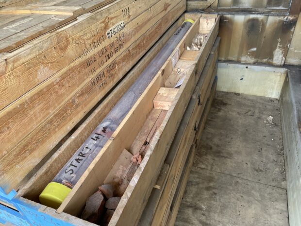
In 2022, we commissioned British Geological Survey to undertake a modern re-survey of the Fell Sandstone Formation and surrounding strata to improve our understanding of the regional groundwater system. This has now been turned into a Geological Story Map that has just been published on the BGS website. Before then the last geological survey of the Berwick area was back in 1922.
This updated mapping will help us when considering extensions to abstraction licences, where we require good quality and up to date information on the water environment, including an understanding of the geology, hydrology and hydrogeology.
Each catchment has a Common End Date (CED) for abstraction licences, at which point we have to consider the impact from the abstractions and the on-going need for the water use.
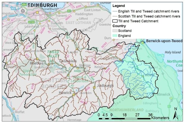
The Till and Tweed catchment - which wholly falls within the Environment Agency’s North East Area - has a Common End Date of 31 March 2027, which is fast approaching.
Conditions
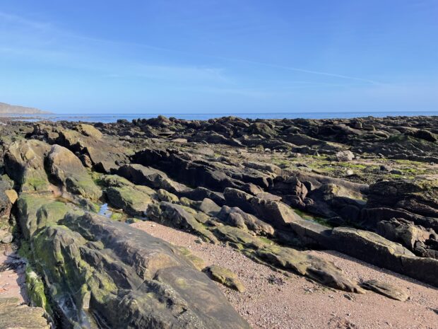
The geology of north Northumberland, along the border with Scotland, is very complex comprising of three main formations including the Fell Sandstone, Ballagan (Cementstone) and Scremerston Coal Measures.
The Fell Sandstone Formation is the principal aquifer supplying drinking water to the Berwick‑upon‑Tweed area and is a vital resource for farming and industry across the Till and Tweed catchment within England.
Due to the complexity, there are gaps in understanding of the geology and hydrogeology of the area resulting in difficulty undertaking our regulatory role in protecting groundwater for the area.
Abstractions
Many abstraction licences within the catchment have a time limit of 31 March 2027, at which point we will assess their sustainability and whether they can be renewed for up to a further 12 years.
Over the past 10 years increased public and private water demand across the area has led to declining water levels and sustainability concerns. Understanding the geology of the aquifer is therefore critical to support our efforts to regulate and manage water abstraction effectively.
Outputs
The outputs of this and other linked projects will ultimately help to fill our knowledge gaps and assist in the production of a numerical groundwater model that will help us fulfil our regulatory role, particularly to tackle any Water Framework Directive (WFD) failures and ensure abstractions are sustainable.
The 2022 geological survey is expected to be included in the next cycle of Berwick geological maps, expected around 2028.
More information on how we make sure there is enough water for the future needs of both people and the environment is available here.
Leave a comment